Directional Drilling in Amarillo
The Panhandle's capital sits on a rim: tableland running flat to the south, the Canadian River's breaks tearing the country open to the north, and Palo Duro — the nation's second-largest canyon — gaping at the city's back door. Panhandle HDD is rim-country drilling where America's beef, wheat, and freight all change hands — and it's ours.
HDD is the whole job here
Amarillo is a city on an edge, and the edge is the estimating map: south and east of town, the high tableland runs level for a hundred miles — deep loams over the plains' cemented layers, drilled with steady production once the hard streaks are named; north of town, the tableland simply ends: the Canadian River breaks drop the country hundreds of feet into eroded red-bed badlands, canyons, and mesas, where the geology the flatland buries lies open to the sky and drilling becomes terrain work — grades, exposed strata, and arroyo-cut approaches. Half of Potter County is breaks. Rim-country quoting asks first which world your alignment lives in, because the two share a county line and nothing else.
The economy is the Panhandle's clearinghouse: cattle country at continental scale — the feedyards and packing capacity that make this one of the beef world's true capitals — wheat and grain moving through elevator towns, and freight crossing the nation at the I-40/I-27 junction where Route 66's mother road became the interstate's main street. Rail runs transcontinental through the city on the BNSF's storied main line, wind farms march every horizon, and the region's industrial register includes work sites with the highest federal coordination standards in the country — priced as the planned, documented scope such neighbors require, and never otherwise. The medical district serves a region the size of a state, and the city's water arrives by aqueduct from Lake Meredith in the breaks plus wellfields across the tableland — a supply story that makes water stewardship a civic instinct.
Palo Duro Canyon anchors the southern drama — the great canyon's tourism and the state park's protected edges — and the breaks hold their own federal treasure at the Alibates flint quarries, where protected lands add care to any nearby alignment. Behind everything sits the network desk: 50,000+ boring calls answered, ~10,000 crossings quoted, 2,000+ drilled, pricing the Panhandle with the rim already in the math.
Fiber-Optic Boring
Medical-district and logistics duct, elevator-town laterals, and city FTTH.
Electrical Duct Boring
Feeders for feedyards, freight, and a grid strung across big wind.
Water & Force-Main Boring
Pressure pipe for a city supplied by aqueduct and wellfield across big country.
Canadian River & Breaks Crossings
The signature Panhandle bore: the river's badlands and the canyon country south.
Road & Highway Crossings
The interstates, the loop, and the elevator-town spokes — rim-named and bundled smart.
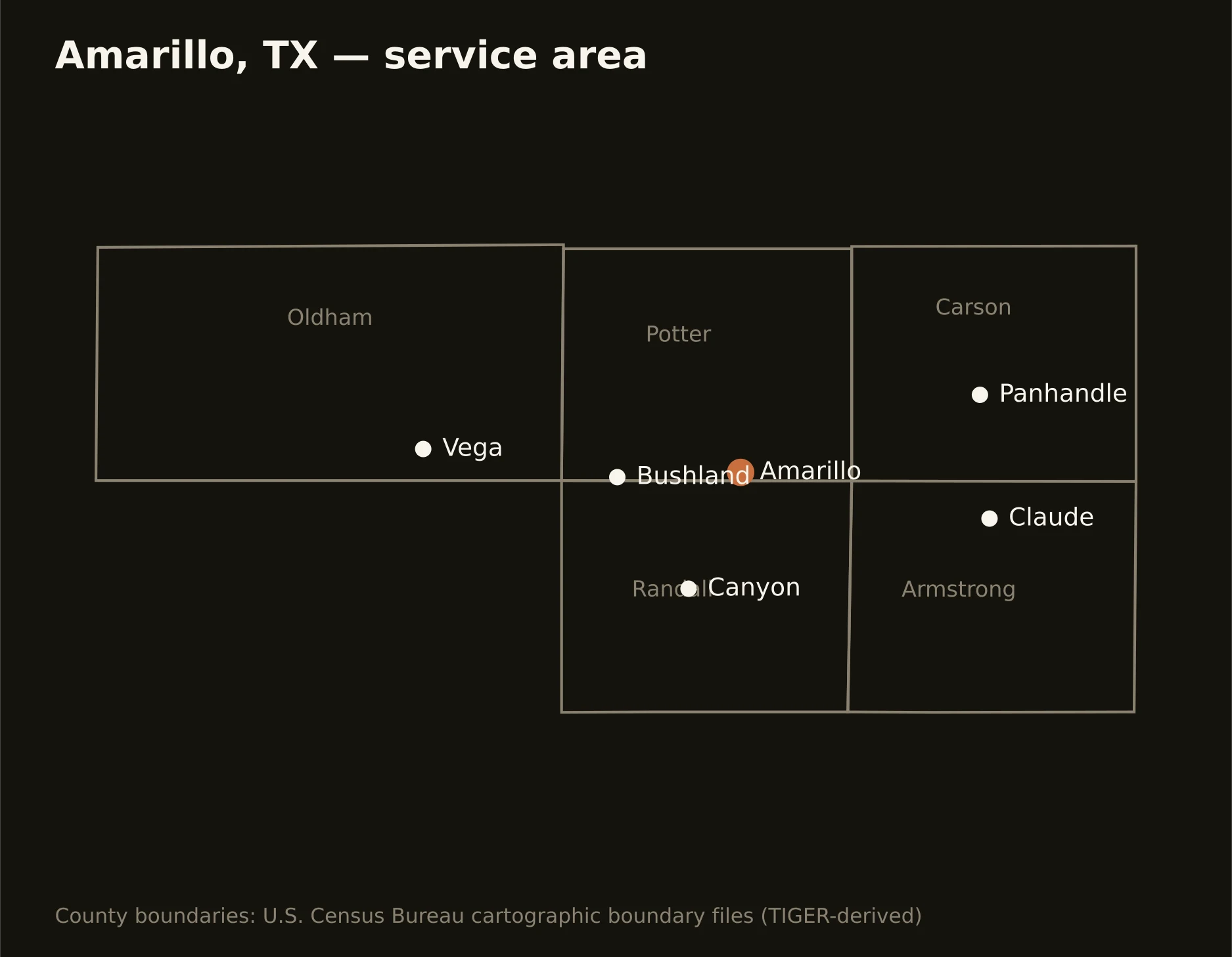
Five counties around the rim — Potter split between city and breaks, Randall carrying the southern neighborhoods to Palo Duro's edge, Carson and Armstrong holding the eastern tableland, and Oldham running Route 66's old miles west. Full county list on the service-area page.